
cape chignecto provincial park
- 地址:
- 开放时间:
- 门票价格:
- 电话:
cape chignecto provincial park印象
-

I had hiked the 51 km camping with my husband and adult son in 2012, but felt strongly called to hike it alone. September temperatures were cool, so cabins made a lot of sense but availability ruled out going around the whole trail. This was a blessing as it opened my eyes to a different trip - Visitor Centre to the Arch Gulf cabin on day one, to the Big Bald Cabin for night two, back to Arch Gulch, and out on the fourth morning. This meant climbing and descending both of the deepest valleys, Refugee Cove and Mill Cove, twice. Setting out alone along the beach to the steps at McGahey Brook was exciting for this 61 year old woman. I carry a SPOT satellite transmitter so my husband can follow my progress. The ascents were pleasant but I had to be very careful on the descents, so was slow but I got there. The trail surface on the 40 degree down slopes was pretty good. With constant use of hiking poles and placing every foot, I felt no anxiety even with bad knees. Legs were tired after the climb out of Mill Cove but fresh bear scat alongside the trail brought a burst of energy and loud singing. I unlocked the Arch Gulch cabin door after 3:15 on the trail. Seemed good to me. One thing I had not been able to find out was, can you cook or at least boil water on the wood stoves in the cabins. For Arch Gulch, you can. I could have left stove and fuel behind. The cabin is super clean and stocked with dry firewood and potable water. The view back to the east looks to Advocate Harbour, to Parrsboro, and all the way into tomorrow.Lovely sugar maple woods take you to Refugee Cove, where I met two hikers also from Dartmouth. The tide was low and the sea calm and sparkling, just gorgeous. Up and out of the cove, through open spruce woods, then lush natural coastal meadows with waist-high ferns and grasses, around the Cape itself until the sea is visible again but looking west now. I did not come across any water sources from Refugee to about Little Bald, stock up from the stream and Refugee (purify it). From the Cape to Big Bald the trail tread is rougher and wetter, with some log walkways to help out. Views west (and down) are superb. The trail passes so casually within a metre or two of steep cliffs. It is backcountry and it is amazing. Just across Big Bald Brook and up up up the hill is a new cabin with a view to Isle Haute. The stove is a different shape and not so good to cook on, but still usable. it rained hard that night and I woke to low cloud and mist which persisted until I arrived back at Refugee again around noon. Surprisingly, this was the best part of the hike. The fog forest was mysteriously foggy and the wet mosses, llverworts, lichens and ferns gleamed with an unusual luminosity as shafts of sunlight broke through. Mushrooms including a patch of Chanterelles had popped up overnight. There had been a touch of frost in places, turning the ferns to hues of red, orange, yellow, brown, pink and even a blue tinge. I have never seen anything like it. Down into Refugee Cove again, I spread out my wet gear on the beach stones to dry. Another solo woman hiker, from Ontario, was exploring the cliffs at low tide. We exchanged greetings. I thought I knew the cove well, but the tide was so low she had found new cliff caves and strange formations, and urged me to spend some time exploring too. Up the steep slope and an hour of easy sugar maple woods to Arch Gulch for my last night. I had timed things to reach Mill Cove in the morning an hour before low tide. There is a set of steps, not maintained and carrying stern warnings, leading down to a lovely waterfall and the shore. Cross the brook, scramble over refrigerator-sized seaweed covered slippery boulders, and you can get to a "pinch point" where there is beach to walk around within perhaps half an hour of low tide. Then an hour of beach walked gets you out, saving the wearying climb back out of Mill Cove. It is essential to understand the tides and the effect of onshore wind before attempting this, but it is very doable. Climbing over slippery boulders was the hardest part, I had to take my pack off and shove it ahead to help with balance. Perhaps at extreme low tide there would be more gravel beach exposed to avoid the boulder scramble, which I found difficult but still pleasing.There were moments when I thought, "this is the last time my body will allow me to be here," but home after a hot bath, I'm already planning a return. The cabins are the key for me, at about $50 a night for the whole cabin.
-

We were visiting this park on a rainy day in august.That is why we decided to do a shorter hike, because we wouldn't like to get soaked.We went for the trail along the beach and then up the hill (approx. 5 km loop)The path was very well signed, and in good condition (even during this rain)After the hike we could change out of our wet clothes in the washrooms, which are big enough to move around a little bit.
-

After a pleasant couple of hours hiking the Fundy Ridge Trail (which does not require the 3-4 hours noted in park literature) in the morning, we inquired at the visitor's center about short hikes in the Eatonville day use area. There were no trail maps for Eatonville available at the visitor's center in West Advocate, and we arrived there to find their center closed. There were no signs or trail maps posted that we could find anywhere, and the upshot was that we did not enjoy our time at that part of the park and found the afternoon disappointing.
-

It's beautiful! We went on a kayaking overnight with NovaShores, and loved it! One of the major benefits is that it's out of the way and not crowded (unlike some other areas on the Bay of Fundy). We had the whole beach to ourselves and only saw about 5 other people the whole day.
-
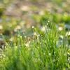
Hiking in the beautiful Eatonville trails, listening to the wind, nature and the waves...........what better place to forget about your daily troubles and enjoy nature.
-

Yesterday, September 27th, was a beautiful day to experience the trail system at Cape Chignecto Provincial Park. Phil and I had never been there before and really did not know too much about it, other than there was a trail system with one being approximately 50 km in length. Always looking for a challenge we decided that we would try to power hike/run/jog/hobble/crawl around the trail loop as fast as we could. This turned out to be quite a feat for us weekend warriors as there were some terrific climbs and descents sprinkled throughout the trail. We did manage to get through the trail in 10 hours which is quite surprising when you consider the spectacular scenery that kept distracting us from our task at hand. The Minas Basin, The Bay of Fundy, Isle Haute, the "3 sisters" rock formation, the numerous coves and beaches were all marvelous. We also had to stop and look at many of the amazing cliffs that we were running by. Sometimes within a meters distance. And I'm guessing, but several of them had to be between 150-200 meters high. Absolutely amazing. If you are out on this trail you have to soak your legs in the Bay of Fundy. We did this at the halfway point and did it ever rejuvenate my tired and aching legs. I plan to visit this trail again, at a more relaxed pace, just to take in the many vistas that I no doubt missed. I also would like to send out a thank you to the registration center staff member "Tex" for being so helpful. Our battery was dead when we came back to the car park and he was very helpful in getting us back on our way home. Thanks.A great park, trail and day.
-

WE stayed at the driftwood chalets-highly recommended. They were about 1/2 hour walk to the park entrance.The trails were challenging and very scenic,I would not recommend these traile to people how do not hike regularly. The day hikes at the Eatonville entrance are not difficult but are under 3 km loops. I liked to hike about 6-8 hours aday and want to have a good work out, The chignecto and Eatonville trails were just right for me
-

Do not take the Eatonville to Seal Cove hike. It is only in the woods and the scenery never changes. The trail is very muddy with lots of slippery tree roots. We never made it to Seal Cove as the scenery was just too boring. I would try to find another hike that goes along the cliff with ocean views.The area itself is very scenic.
-
I did one of the short trails, which was nice but I bet the longer multi-day hike would be more interesting!
-

This summer we decided to do a short backpacking trip in Chignecto Provincial Park. What a beautiful area, it takes my breath away when I'm there. The tides in this area are something to see!We started by camping at Eatonville (also called Elliott field, I believe) where we had site 9 by the river. (Site 10 is in the field, good if you don't like the sound of the river). We needed to use our bug spray. From there, we hiked in to a campsite at Seal Cove. Wow, what a gorgeous beach - not the sandy type, but mainly medium sized pebbles. We found lots of driftwood to sit on. The beach is removed from the campsites so that you're not listening to the roaring surf all night! Not all the sites had picnic tables, although ours did. Note that the sign going into the sites says "sites 1-5" but actually sites 6 and 7 are there as well. They must have been put in after the sign went up. Here, we didn't need our bug spray as the breeze from the ocean kept them away.The hike into Seal Cove is fairly rugged, with the trail occasionally narrowing.The first part is through woods, sometimes along a stream, and later along the coast. Most of the look-offs were spectacular. The trail is well marked with red markers - there were a couple of spots where logs were placed to stop you from taking the wrong path but it's easy to absentmindedly step over those logs, so good to pay attention. The trail itself features a lot of roots, some strategically-placed boards for wet areas, a few bridges (some of which could use some work) and some tiny streams to be crossed. We saw no hikers on the trail itself, but there were 3 sites occupied at Eatonville and 1 other site occupied at Seal Cove.We hiked back to the Eatonville campsite the next day and the trip back seemed easier than the trip in.